Knowing the location of gas stations is mandatory and essential for road users. Surely, you are already aware of the location of gas stations around your area or on the routes you frequently travel.
However, in some cases, when you are on a business trip or traveling in unfamiliar areas, you may have difficulty finding a gas station. This is also a question that many people have: is there a way to find the nearest gas station? In this article, FPT Shop will answer your question!
How to find the nearest gas station using Google Maps
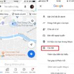
Step 1: Open the Google Maps application on your device. If you don’t have it, you can go to Google Play if you are using an Android device or go to App Store if you are using an iOS device to search for and download the application.
Step 2: Google Maps will suggest some places such as: Private Houses, Restaurants, Gas Stations, Hotels,…. > You select the category Gas Stations.
/fptshop.com.vn/uploads/images/tin-tuc/142406/Originals/tra-cuu-tram-xang-gg-maps-1.jpg)
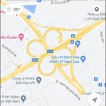
Step 3: All gas stations will appear on the entire map (Red location marker). At this point, you can easily see which gas station is closest to you. You click on the Red marker, then the information of that gas station will be displayed below.
/fptshop.com.vn/uploads/images/tin-tuc/142406/Originals/tra-cuu-tram-xang-gg-maps-2.jpg)
Step 4: You select the category Directions > Start. Google Maps will guide you to the chosen gas station.
/fptshop.com.vn/uploads/images/tin-tuc/142406/Originals/tra-cuu-tram-xang-gg-maps-3.jpg)
In case you want to look up which gas stations are on your travel route, do the following:
Step 1: Open the Google Maps application > Tap and enter the location you want to go to in the Search here section.
Step 2: Select the category Directions below > Tap the magnifying glass icon > Suggestions will appear, you choose the category Gas Stations.
/fptshop.com.vn/uploads/images/tin-tuc/142406/Originals/tra-cuu-tram-xang-gg-maps-4.jpg)
Step 3: At this point, the gas stations along your travel route will appear. You can view and choose a suitable gas station to use.
/fptshop.com.vn/uploads/images/tin-tuc/142406/Originals/tra-cuu-tram-xang-gg-maps-5.jpg)
Conclusion
That’s how you can find the nearest gas station using Google Maps with just a few simple steps. Surely, this will be extremely useful information for everyone, so remember this article. Wish you success!


