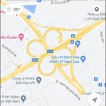
Although technology has reduced the use of post offices, they still provide an essential service and play a significant role in various activities. If you’re looking for the nearest post office but don’t know where to find one, FPT Shop can guide you on using Google Maps to locate them easily.
Why Use Google Maps to Find the Nearest Post Office?
/fptshop.com.vn/uploads/images/tin-tuc/161861/Originals/B%C6%B0u%20%C4%91i%E1%BB%87n%20g%E1%BA%A7n%20nh%E1%BA%A5t%20h%C3%ACnh%201.jpg)
- You can find all the nearest post offices.
- You can access detailed information about each post office, including images, locations, distances, working hours, contact phone numbers, customer ratings, and more.
- You can view the status of post offices and vehicles (crowded, empty, etc.).
- You can receive directions on the map or through voice guidance for the shortest and most convenient route to your selected post office, even while driving.
Detailed Steps to Find the Nearest Post Office Using Google Maps
On Your Phone
Step 1: Tap on the Google Maps icon on your phone to open the application. At the main interface, tap on the search box labeled “Search here” at the top and enter the word “post office.” Choose the line with the word “post office” in the suggested list or click on the magnifying glass icon on the keyboard to start searching.
/fptshop.com.vn/uploads/images/tin-tuc/161861/Originals/B%C6%B0u%20%C4%91i%E1%BB%87n%20g%E1%BA%A7n%20nh%E1%BA%A5t%20h%C3%ACnh%202.jpg)
Step 2: Tap on the filter icon at the beginning of the line below the search bar. In the “Sort by” dropdown, select “Distance” and click on “Apply.”
/fptshop.com.vn/uploads/images/tin-tuc/161861/Originals/B%C6%B0u%20%C4%91i%E1%BB%87n%20g%E1%BA%A7n%20nh%E1%BA%A5t%20h%C3%ACnh%203.jpg)
Step 3: To view the entire list of nearest post offices, click on “See list” at the bottom right of the screen. Click on the name of a specific post office in the displayed list to find out more information, such as coordinates or house number, opening and closing hours, phone number, images, and customer ratings.
/fptshop.com.vn/uploads/images/tin-tuc/161861/Originals/B%C6%B0u%20%C4%91i%E1%BB%87n%20g%E1%BA%A7n%20nh%E1%BA%A5t%20h%C3%ACnh%204.jpg)
For more information, you can refer to: Where is the Nearest Restaurant? Guide to Finding Nearby Restaurants
On the Computer
If you’re using a computer to find the nearest post office, you can access Google Maps online without installing the application. Here are the steps:
Step 1: Go to the Google Maps website using this link: https://www.google.com/maps. Enter “post office” in the search box labeled “Search on Google Maps” and select the magnifying glass icon or press Enter to start searching.
/fptshop.com.vn/uploads/images/tin-tuc/161861/Originals/B%C6%B0u%20%C4%91i%E1%BB%87n%20g%E1%BA%A7n%20nh%E1%BA%A5t%20h%C3%ACnh%206.jpg)
Step 2: On the left side of the screen, you’ll see a list of the nearest post offices, and the right side will display a map with markers indicating the post office locations. Click on the markers on the map or the names in the list to view more detailed information about each post office.
/fptshop.com.vn/uploads/images/tin-tuc/161861/Originals/B%C6%B0u%20%C4%91i%E1%BB%87n%20g%E1%BA%A7n%20nh%E1%BA%A5t%20h%C3%ACnh%207.jpg)
Step 3: Choose “Directions” to receive precise instructions for the exact and fastest way to reach the post office.
/fptshop.com.vn/uploads/images/tin-tuc/161861/Originals/B%C6%B0u%20%C4%91i%E1%BB%87n%20g%E1%BA%A7n%20nh%E1%BA%A5t%20h%C3%ACnh%208.jpg)
Note: If your computer doesn’t have geolocation enabled, you should enable it for Google Maps to determine your current location and provide accurate directions. Alternatively, you can manually enter the starting point if you prefer not to use geolocation.
Conclusion
This article provided detailed instructions on how to find the nearest post offices using Google Maps and obtain directions quickly. We hope you find this helpful!


