


The COVID-19 pandemic has been evolving in a complex manner, and you might have come across the terms “green zone”, “red zone”, “orange zone”, and “yellow zone” somewhere.
However, not everyone understands the meaning of these terms. The following article will help you understand the concepts of these zones and how to distinguish areas with a risk of COVID-19 infection.
1 What is a Green Zone?
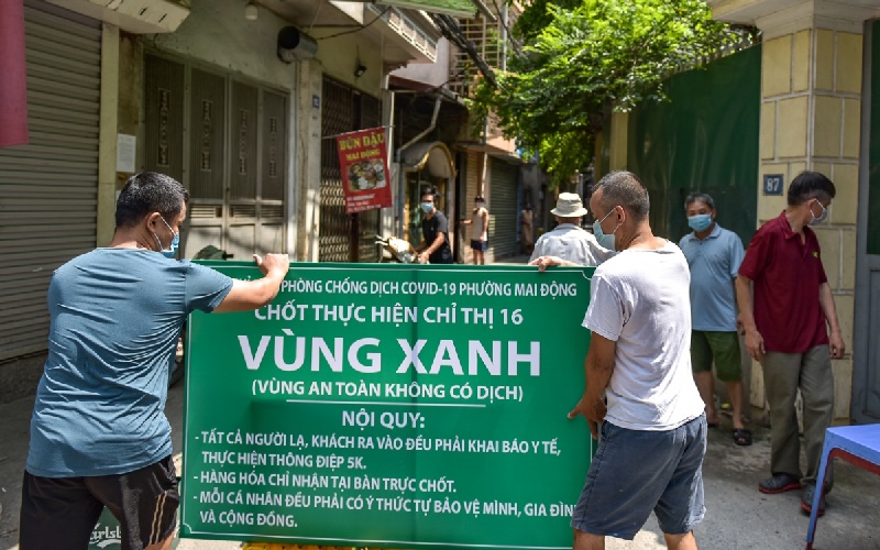 Green Zones will have signboards
A Green Zone is a new normal area where there is no possibility of COVID-19 infection. Each locality has its own way of demarcating and protecting Green Zones. A Green Zone can be an alley, a lane, or an area with no reported COVID-19 cases, and it will have signboards at the entrance and checkpoints.
Strangers are not allowed to enter Green Zones, and if there is a necessary reason to do so, they must undergo health declarations and follow the 5K rule. Residents of Green Zones who wish to go out also need to have travel permits, shopping vouchers, or work passes.
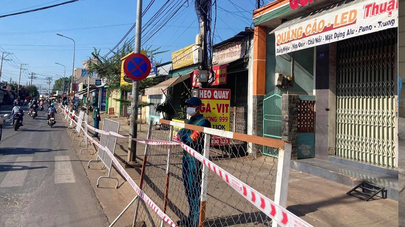
2 What is a Yellow Zone?
A Yellow Zone is an area with a risk of COVID-19 infection. The determination of a Yellow Zone is based on epidemiological factors as follows:
- Commune level: There is an F0 case with a community-based source of infection.
- District level: Within 14 days, the number of F0 cases with a known source of infection exceeds the rate of 1/100,000 people.
- Provincial level: Within 14 days, the number of F0 cases with a known source of infection exceeds the rate of 1/100,000 people.
 Yellow Zones are areas with a risk of COVID-19 infection
In Yellow Zones, the following preventive measures are implemented:
- Contact tracing, zoning, and isolation following the guidelines of the Ministry of Health.
- Temporary closure of high-risk businesses such as nightclubs, karaoke bars, pubs, and massage parlors.
- Mandatory health declarations for those at risk.
- Limiting gatherings and crowded events.
3 What is an Orange Zone?
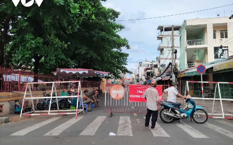 Orange Zones have a high risk of COVID-19 infection
An Orange Zone is an area with a high risk and a high possibility of COVID-19 infection. Typically, an Orange Zone includes agencies, units, hospitals, markets, factories, healthcare facilities, and production facilities, among others.
In Orange Zones, residents are advised to comply with health declarations using QR codes when coming to work, labor, or shopping.
4 What is a Red Zone?
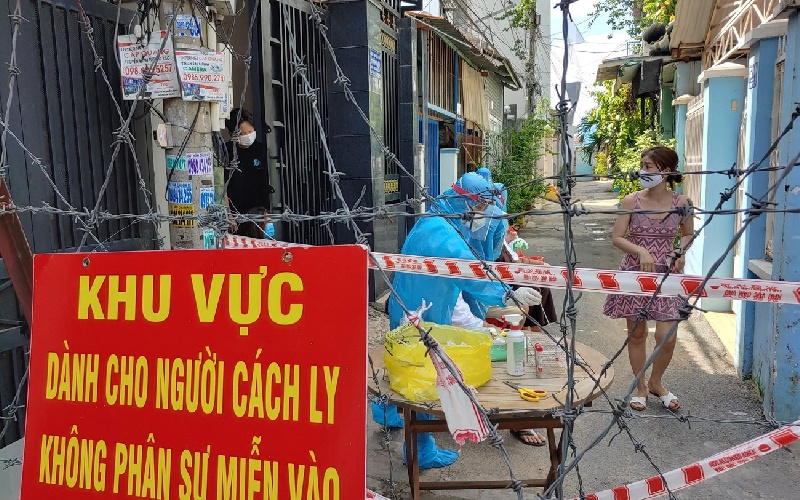 Red Zones are relatively dangerous areas
A Red Zone is a relatively dangerous area with a very high risk, and people are advised to stay away from this zone due to the risk of COVID-19 infection. This area is usually cordoned off or isolated.
The Red Zone will be managed by medical and military forces, who will conduct zoning, testing, and isolation as soon as possible, while also narrowing down the affected area to minimize the risk of infection and quickly control the outbreak.
5 Green, Yellow, Orange, and Red Zones in Ho Chi Minh City
On September 22, 2021, the Ministry of Health assessed and classified the risk of infection in the districts of Ho Chi Minh City.
According to the Ministry of Health’s assessment, the zones in Ho Chi Minh City are as follows:
- Green Zone (new normal): Cu Chi and Can Gio districts, and District 7.
- Yellow Zone (at risk): Thu Duc City, Binh Chanh district, and Phu Nhuan district.
- Orange Zone (high risk): 14 units including Districts 1, 3, 5, 6, 8, 10, and 11, as well as Nha Be, Tan Binh, Go Vap, Binh Thanh, Hoc Mon, Binh Tan, and Tan Phu districts.
- Red Zone (very high risk): 02 units, District 4 and District 12.
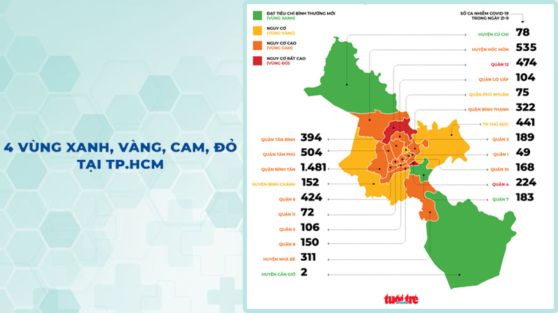 Green, Yellow, Orange, and Red Zones in Ho Chi Minh City
This zoning map will help you understand the epidemiological situation in Ho Chi Minh City. Additionally, you can refer to the COVID-19 map in other provinces and cities to access information such as isolation areas, lockdown points, positive cases, epidemiological points, medical facilities, and essential goods locations… You can easily find the places you are interested in by searching for the address on the search tool.
It is important to note that all data on the COVID-19 map is provided by the City Disease Control Center (HCDC) and is updated immediately after the official announcement from HCDC, ensuring the accuracy of the information.
People can also access the COVID-19 map of Ho Chi Minh City on their phones, computers, or via the web by visiting one of the following addresses: https://hatangdothi.tphcm.gov.vn/covid19/, Cổng 1022 at https://1022.tphcm.gov.vn, and selecting the COVID-19 information banner.


